
 |
 |
|
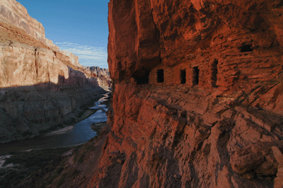
How did I ever end up on a sheep trail 200 feet above Malgosa Creek? This was the question that occupied me while slogging through the jungle of reeds, trees and shrubs the trail had led me to. There was no room to move and I knew this tangle could not possibly be part of the Malgosa pour-off bypass. Nevertheless, there I was fighting through the maze of branches to reach the rocky slope on the other side. But I'm getting ahead of myself. The sheep trail was on Wednesday and this trip had begun on Sunday.
Sunday morning, I made the 3 1/2 hour drive from Flagstaff to the Saddle Mountain trailhead. After chasing a couple of sandwiches with a bottle of Gatorade, I strapped on the Aether 70 and hit the trail. Trail #57, to be exact. It's three miles begin with a straight-line shot up the slope of a hill before winding around to the south side of the hill and making a quick descent to the bed of Saddle Canyon. Trail #57 then weaves from one side of the creek bed to the other and exits, following a series of ridges up to the saddle west of Saddle Mountain. It's here that the Nankoweap trail starts, and here that I camped on the night of October 4.
The view from the saddle overlook was spectacular. But whenever I tried to move onto the point for a better look, the gusting wind would blow me off balance. It was strong enough that I decided to camp downtrail a ways in the trees. Even that didn't help. The wind bludgeoned my tent all night long. Each assault began with a low moan as the wind swirled building strength. The noise grew louder with each passing gust until the last volley would grab the tent and shake it. And then there would be silence. But only for a few minutes, until the next wave began.
Despite the chaos outside my tent, I did manage to sleep in fits and starts. When I awoke for the last time at 5:40 am, the wind was still howling and it was bitterly cold. I took breakfast at the rim in the shelter of a juniper tree. While heating water for coffee, I watched the first light of day splash across the north rim of Grand Canyon. Gusts swirled around me but it was calm in the lee of the juniper.
After breakfast, I returned to camp to pack my gear. With the pack ready, there was just one task left to perform. I returned to the overlook to make a food and water cache. I was planning to hike out and drive home on the same day. But if it was too late or I was too tired to drive, the cache would provide me water, dinner and a breakfast for one last night at the canyon. The cache included three liters of water, one Mountanin House meal, one miniature Hershey bar with almonds, one packet of apple cider mix, one packet of oatmeal, one-half bagel and a packet of instant coffee. It was 8:16 am when I left Nankoweap trailhead.
The trail begins with a brief, steep descent through the Esplanade layers of sandstone. Once at the base, the trail seemingly levels off for a long traverse at the base of the Esplanade. In fact, the constant up and down of the trail offers regular reminders that one is hiking a Grand Canyon trail. Hiking the upper part of Nankoweap en route to Tilted Mesa, I met two hiking parties. The first was two guys who had been in the canyon since the previous Wednesday; six days. The other was four guys who'd been in one day longer. All six agreed that the trail through the Muav was in bad shape. One hiker said this was the worst he'd seen it in his four times down Nankoweap.
About thirty minutes into the hike, I passed through a section of trail that had recently been wiped out by a rock slide. This was similar to the kind of obstacle one encounters on the Hermit trail. An hour of hiking brought me to Marion Point. I took a fifteen minute break for snack and some water. The remainder of this upper section of Nankoweap winds in and out of a series of small bays between Marion Point and Tilted Mesa. It was almost 12:00 noon when I arrived at the cairned downclimb that begins the steep descent to Nankoweap valley.
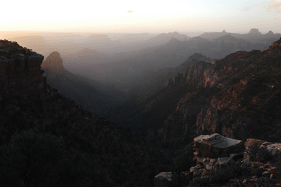
The descent begins at Tilted Mesa, contouring down along the west side through Supai and Redwall formations. Things got interesting in the Muav layer. The upper portion wasn't too bad. It reminded me of some descent trails on the Tonto. But soon enough, any semblance of a defined trail disappeared and was replaced by steep descents through crumbly shale. This section reminded me of the descent routes from the Tonto to the river we used in March on the Crazy Jug hike. Cairns and evidence of recent use let you know you were on "the trail." But this was a classic Grand Canyon backcountry route, steep with not a lot of room for error.
Eventually, the trail entered the Bright Angel Shale and, after that, through the Tapeats. The Tapeats was interesting. It looked like some alien landscape. At the base of the Tapeats, the trail emptied into the bed of a drainage. It followed the drainage for a couple hundred meters before emerging onto gently sloped plain. Winding through cactus and brittlebush, the trail gradually dropped toward Nankoweap Creek. It ended at a tree by the flowing water, a shady cool rest spot on a warm October afternoon. It was 1:40 pm.
I dropped my pack at the tree and scouted upstream for a campsite. I chose a flat piece of ground protected from the wind by a rock wall. Nankoweap Creek flowed by just feet from the site. Within fifteen minutes, I had retrieved my gear from the tree and was going about the business of setting up camp. While putting up my tent, several members of a river party walked past. They had been exploring up canyon on a day hike and were on their way back to Nankoweap beach. Later, I did my own short upstream exploration.
The rest of the day at camp was occupied with the mundane tasks of Grand Canyon backpacking: filtering water, washing off the trail dust, checking the feet for blisters and so on. On the dinner menu for the night was lasagna with meat sauce, hot apple cider and a miniature Hershey's bar. Lasagna is my favorite Mountain House entree. Exhausted and sheltered from the wind, I slept much better than the previous night.
I was up at 5:45 am the next morning. The first order of business was stowing my sleeping bag and organizing the items in my tent. Breakfast included the usual fare of one-half bagel with peanut butter, a packet of instant oatmeal and a cup of hot coffee. After breakfast, I packed the tent and was on the trail at 7:46 am.
My goal for the day was to hike the Butte Fault route up and over to the south into Kwagunt canyon. My plan was to hike to the saddle immediately northeast of Nankoweap Butte and descend a ridge on the other side into Kwagunt valley. During my preparation for this hike, I'd found several descriptions of the Butte Fault route on the Internet. Most are sketchy at best. I decided to begin my approach to the northeast saddle from a drainage that runs north from Duppa Butte along the western slope of Nankoweap Butte and into Nankoweap Creek.
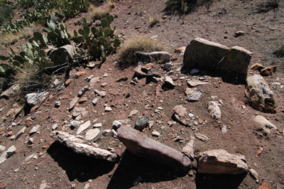
I saw precisely two cairns all day. The first was a lone cairn in the drainage that may have been placed to mark an approach path to a cliff edge offering the beginnings of a route up to the saddle. That didn't look too promising so, I dropped my pack and explored further up the Duppa Butte drainage. Within a few minutes, I came to a weak seep on the left. Water was pooled here at the foot of a boulder-clogged drainage. Checking my map, this appeared to be the drainage I had identified as a potential access route to the saddle.
Forty-five minutes of boulder scrambling brought me to a wide open creek bed with a gentle slope. Comparatively speaking, this was like walking a groomed footpath. After a few minutes, I arrived at a minor drainage merging from the south. There was reddish, rusty water in this drainage and, after some consultation with the map, I decided to continue along the main bed. I followed this bed until it curved northeast and narrowed to a point that a single large boulder would make it impassable. I exited to the right onto a Tapeats slope. Soon after, I crossed over to get left (east) of the drainage and followed the slope of the hill up to the Nankoweap Butte saddle.
Closer to the saddle, the rocks, junipers and shrubs yielded to a soft shaley surface mostly devoid of vegetation. Angling across this terrain required constant attention to avoid slipping down the slope. Nearing the saddle, the landscape took a rather bizarre turn. It was a mix of large stones sitting atop a hard-packed aggregate. It reminded me of photos of the surface of Mars.
The second and last cairn I saw on this day was a reasonably sized stack assembled at the Nankoweap Butte saddle. It had taken 1:55 to ascend from the seep to the saddle. After a short break, I began the descent into Kwagunt valley at 11:00 am. Originally, I had planned to follow the spine of a ridge into Kwagunt. This is the route described in the online reports I've read. However, rather than follow this obvious route, I decided to traverse the soft slope below Kwagunt Butte to the west. The rocky hills in that direction looked to offer a route to the hill overlooking Kwagunt Creek. I suspected there may be Puebloan ruins on this hill and was interested in seeing for myself.
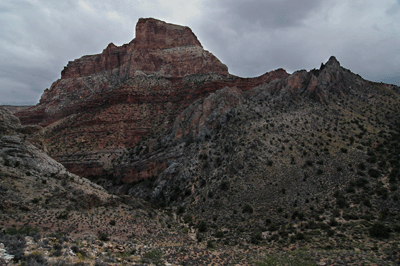
About halfway across the shale slope, I realized my choice had probably added a solid hour to my hiking time. But I was committed and kept moving forward. It was 1:15 pm when I finally set foot on the hill overlooking Kwagunt Creek. A short reconnaissance followed as a I hiked to the southeast corner, then followed the southern edge of the hill to the west. It seemed like the perfect place to build but there was no obvious evidence of past occupancy. I crossed a game trail at the western end of the hill and the trail led south down to a lower shelf of flat land immediately on the northern edge of Kwagunt Creek. When I got down to this shelf I stopped short...at an ancient stone wall. It wasn't tall but the stones were arranged so unnaturally that it had to be manmade. Several pottery sherds on the ground within the wall confirmed its ancient origin. After exploring the shelf and finding two more suspicious stone alignments, I decided to drop into the creek bed.
It was now almost 2:00 pm. I still hadn't eaten lunch but wanted to find a campsite, first. I had a notion about exploring upstream in Kwagunt and had read that there was a reliable spring in that direction. Checking the map, I figured it wouldn't take more than about 30 minutes to reach the spring. But within fifteen minutes, I was stopped cold by a waterfall in a narrow section of Kwagunt Creek. The creek was pinched on both sides by dark vertical rock walls. I could have taken off my boots, rolled up the pant legs and climbed around the falls. Another option was to climb up and over along the top of a stone wall. But it was late in the afternoon and I had neither the energy nor the inclination to commit to either bypass without certainly of finding a good site.
Frustrated by what should have been a minor obstacle, I turned around and headed back downstream. Eventually, I followed the creek all the way to where it junctions with the Butte Fault route. Here, there were a couple of nice campsites with easy access to water. Oh, the irony!
That night, I decided to make Wednesday an easy day. The plan was to sleep in, break camp leisurely, and make the easy walk down Kwagunt Creek to the river and a beach campsite. There was a light rain during the night but I had covered my backpack and food sack before bed so, everything stayed dry. I awoke at 6:40 am, which is essentially sleeping-in for me, while in Grand Canyon. During breakfast, clouds rolled in. These weren't threatening clouds, just soft gray cumulus that blocked the sun. And it presented an interesting opportunity.
I realized conditions would be perfect for a hike up and over into Malgosa along the Butte Fault route. It didn't take long to change my plans for the day. At 8:35 am, I left camp and started hiking south. Climbing out of Kwagunt Creek, the way up to the saddle along the Butte Fault was obvious. After making the short trek across an open cactus field, the line went up a drainage for a quarter-hour. Exiting the drainage to the left, my route remained on the boulder-strewn slopes following a dogleg-right line up to the saddle. My pace was slow but steady and I reached the top at 10:20 am.
It wasn't what I expected. Before me lay a spacious cactus-studded plain. I walked for some time before finding an overlook off to the right. The view down into the wide-open valley was spectacular. It seemed like a great place for a break so, off came the pack and out came the jerky and trail mix. Next, out came the maps and it was then that I noticed a problem. The scene laid out before me didn't match what the maps were showing or, put another way, the view was not what I expected. Nothing matched up. The maps were right so, where had I gone wrong?
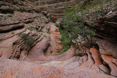
I checked my directions and realized the vista that had made such an attractive rest area was off to the west. If I were at the correct overlook peering into Malgosa, I should be looking to the south. And in that moment, it all became so clear. I wasn't looking into Malgosa; I was looking into Kwagunt. There was Nankoweap Butte, the creek and everything I'd been admiring the previous day. It looked liked an easy walkdown from the overlook into Kwagunt. Good thing I realized my error, now rather than later.
Since Malgosa was the goal, I hoisted the pack and made my way across the cactus plain looking for an overlook with a southern exposure. Climbing to the top of a short crest, the view immediately confirmed that this was the right place. Ominous Kwagunt Butte dominated the sky. A drainage dropped from the crest toward Malgosa. Rather than risk getting ledged out by an impassable pour-off, I chose a line on the opposite side of the drainage. This route would take me down along the slope of another rocky hill. It was 10:55 am when I began the descent and, thirty minutes later, I was walking downstream in Malgosa Creek.
A half-hour into the walk to the river, a light rain started to fall. Instead of remaining feint and sporadic, the rain strengthened to a constant drizzle. The time being close to 12:00 noon, I ducked under cover of a juniper tree for lunch. A short time later, the rain had abated and I was back on track to the Colorado at 12:15 pm. Over the next hour, I encountered and negotiated numerous small pour-offs and two rather large dry falls. It seemed that I should be nearing the river.
Then I came to a huge obstacle, a 30-40 foot dry fall. This was the obstacle I'd read about while researching the hike. Reports indicated a cairned bypass off to the right. Looking that direction, I saw an obvious trail of use. There were no cairns but the apparently recent use indicated to me that this should be the bypass. Without giving the matter much thought, I took it and immediately began climbing high above the creek bed.
I'm not sure when or where I missed the exit from this route but, a half-hour into the bypass, it dawned on me that I hadn't seen any fresh boot prints in several minutes. The path was still clear and well-defined but it didn't show signs of recent use. At least, not by people. I was on a sheep trial about 200 feet above Malgosa Creek, which brings me back to the start of this tale.
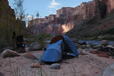
After emerging from the thicket at the seep in the minor drainage, I began scanning along the route ahead for an opportunity to descend into the creek. Even if the sheep trail didn't want to go down, I did. I'd been on this slender thread of a route long enough. Rounding a bend, the slope ahead appeared to offer a route into the creek bed. As with most slopes in the canyon, there was a mix of terrains--grassy inclines, boulder fields and boulder-choked drainages--but I could visualize a line down into Malgosa. So, I bid adieu to the sheep trail and began a careful descent. A few minutes later and it was back to negotiating minor pour-offs in Malgosa. And fifteen minutes after that, I set foot on soft, sandy Malgosa beach.
What a wonderful sight. Fining a break in the tamarisks, I walked to the river and found a small beach for my campsite--"Bill's Beach." After dropping my pack, I decided to make a reconnaissance of the area. Walking downstream along the beach, I found a science station consisting of two equipment posts. One tripod-based post was equipped with solar panels at the bottom and some kind of sensor at the top. The other post, positioned some ten feet away, featured four wedge-shaped vanes with tails. It appears to be some kind of weather station. While photographing this station, I noticed another off in the distance.
The following day turned out to be pretty special. Not than any day in Grand Canyon isn't great--even a bad day in the canyon is better than most days out--but the fourth day of this trip would be memorable for all the right reasons. I woke briefly at 4:19 am and, stepping outside my tent, was greeted by a glorious view. The waning gibbous moon was riding high in Taurus with Orion below and to the left. Sirius blazed white hot from its location just above the canyon rim. The quiet beauty of this celestial show was almost overpowering.
Breaking camp at 8:30 am, I started making the way upstream along the Colorado. The goal for the day was to reach Nankoweap delta to make camp. While preparing for this trip, I'd read that the way would be possible along the river and soon learned a valuable lesson in this regard: stay high above the tammies. The tamarisk-infested shoreline makes hiking along the river practically impossible. Dense thickets of these thorny shrubs will eat a person, alive. My legs and arms--covered with the cuts and scratches from this five-day trek--are testament to the evil intentions of this alien species.

Fortunately, game trails along the ledges some fifty feet above the river make the way from Malgosa to Kwagunt and Nankoweap passable. It was 9:30 am when I arrived at the south end of Kwagunt delta. This delta is expansive. It was nearly a half-hour later when I stepped onto the beach where Kwagunt Creek empties into the Colorado. The beach was in shade so, I took a break to apply sunscreen and prep for spending the balance of the day hiking in sunlight.
One of the pleasures of hiking along the Colorado is watching river parties float past. I had my first such encounter on this hike at 11:18 am about a mile north of Kwagunt rapids. I was standing atop a boulder opposite a small beach and a formation labelled, "Rock Tower," on the topo map of this area when they floated by. There were six large rafts, one smaller raft and two, single-person kayaks in the water. The rafters were a bit surprised to see a hiker in this part of the canyon and asked which route I'd taken. They were on day-six of a twenty-one day trip through Grand Canyon. My goodness, was I envious.
Upstream of Kwagunt, the game trail became better defined from heavier use by hikers and river party day hikers. After a time, I began to recognize one set of boot prints as familiar. I didn't know the person who had made those tracks. I did know that we probably shared a common mission: get to Nankoweap. So, in an odd way, I did not feel so alone on this trail. I had a hiking companion, a person who was walking the trail with me. He may have done so days before my passage but we shared that trail as much as any two people can share a trail in Grand Canyon.
Around noon, the game trail bent left into the deep recesses of a large drainage. At the crossing, the drainage was still in the shade so, I stopped for lunch. Resuming the trail twenty minutes later, I was soon treated to my first good view of the Nankoweap delta. Now, with my goal in sight, the gap between me and Nankoweap closed significantly with each stride. The trail seemed to improve, as well, which allowed for a quicker pace. It was just after 1:30 pm when I set boot on the south end of Nankoweap delta.
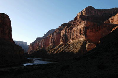
It took awhile to find a path to the beach. Back on the game trail, I had spied a small secluded beach at the south end of Nankoweap that looked just right to me. When I finally arrived, the beach was unoccupied so, I staked my claim. The next two hours were spent leisurely setting up my tent, organizing gear and pouring buckets of cool Colorado River water over my body to wash off the trail dust. My beach site was sunny, calm and secluded; a perfect spot for a relaxing day in the canyon.
While I was doing housekeeping, a river party that had stopped at Nankoweap for lunch--they were at the larger upstream boat beach--floated by. We waved and exchanged greetings. They were also on a twenty-one day trip. Again, I was envious...but not for long. Catnapping on my little beach cured me of that condition.
Late in the afternoon, I decided to hike up to the granaries. Another river party was just pulling in to the upstream boat beach when I left camp. After a bit of searching, I found a well-used trail heading in the right direction. This was probably the trail to the granaries so, I followed it north toward the slopes at the base of the vertical canyon wall. The trail eventually became a constructed stone staircase leading upward. At one point, I looked up and caught my first glimpse of a granary. Twenty minutes of climbing brought me to my destination.
The first cluster of four storage rooms is easily accessible. I didn't go inside, just took photos from various angles at their level. I also managed to get one level below a second set of granaries but could not get to their level. Two beams were sticking out of the upper granary in this stack. I couldn't tell if the beams were ancient tree branches or agave stalks. Another isolated granary was just too difficult to reach. And so, after admiring the ancients' handiwork and imagining what life may have been like for the original architects, I began the return trip to camp.
The trail I was on took me right through the river party's campsite. I stopped to chat with some of their group. They were from California and Seattle. Several had made other river trips but others were doing this as a first-time adventure. One gentleman, John, would be leaving the group at Phantom Ranch. He had a shuttle to catch at the Bright Angel Lodge and had been told to budget five hours for the hike out. I suggested he budget six or seven hours. I'd done the hike out from Phantom in March in five hours, but that was after nine days in the canyon. I was in prime physical condition and walking on trail-hardened legs carrying a light pack. John was obviously fit but had no canyon hiking experience. Budgeting the extra hour or two seemed more realistic.
Back at camp, I could see that gusting winds had collapsed my tent. Inside, everything was covered with a fine layer of sand. The next hour was spent relocating my tent and gear to a more sheltered location, and cleaning the sand out of everything. When I was finally ready to make dinner, twilight was falling and day was yielding to night. Walking to the river to get some water to filter, I noticed something along the shore. It was a beaver and he was feeding on river grass in the shallows. He casually slinked into the water to put some distance between himself and me. Looking downstream along the beach, I spotted another beaver feeding just beyond a clump of long grass. I've read about but never seen beaver in the canyon, which made this unexpected sighting the highlight of my day.
In honor of the beaver, the granaries, river parties and other special moments from this day, I decided to add a treat to dinner. Out came the tin of oysters. I ate half the contents straight from the can. The remainder were added to a Mountain House meal. Dinner was finished with a small Hershey's chocolate bar with almonds and a large bowl of hot apple cider. I then sat in the sand and made my journal entry for the day. It was fully dark and I wrote by headlamp light. Looking up, the summer Milky Way painted a white stripe of light across the sky. Mighty Jupiter blazes as a yellow beacon in the south. It was a bookend moment and the perfect end to another great day in Grand Canyon.
 |
Friday, October 9 would be my last day in the canyon on this trip. I still had two nights remaining on the permit, but I had seen what I wanted to see and, frankly, the thought of spending Saturday relaxing at home with a cold beer in hand and some college football on TV was very appealing. After breaking camp, I stopped by the river party camp to say my good-byes. Heading out from Nankoweap beach, I dropped my pack at the junction with the staircase and made a final stop at the granaries to see them in the early morning light. Returning to my pack, the game was on and I headed north to Nankoweap Creek. It was 8:05 am.
Nankoweap Creek is beautiful. With a moderate, late autumn flow and a host of minor falls dotting its length, this creek runs through a continual string of little oases. Especially attractive, was one section featuring a string of small waterfalls flowing within a fluted, white stone narrows. The route jibed from one side of the creek to the other and occassionally exited to follow a path atop a shelf in the canyon.
It was 9:40 am when I arrived at the tree at the base of Nankoweap trail. Over the next forty minutes, I snacked, added three freshly-filtered liters of water to my supply and applied mole skin to my left pinky toe. Ready for this last long leg, I strapped on the Aether 70 and began the hike to the rim. The time was 10:25 am and, over the next 2:45, steadily made progress up through the Tapeats, Muav and Redwall to Tilted Mesa. It was a long, hard slog. I took advantage of rare spots of shade to take short breaks in the Tapeats and atop the Muav. During the ascent, I made several mental comparisons between this and other difficult Grand Canyon trails, including Boucher, Hance and Tanner. In the end, I have to say that Nankoweap is the more challenging. It is the most difficult of the named trails I've hiked.
After a lunch break on Tilted Mesa, I resumed the hike to the rim secure in the knowledge that the most difficult section of the trail lay behind. It was 2:00 pm and my day would be a race against time. If I were going to make the drive home on this night, I would have to hike the three miles from the trailhead to the Saddle Mountain parking area in deep twilight or darkness. Already exhausted from the initial climb from Nankoweap Creek, I kept a delicate balance between maintaining a steady pace and conserving energy. I also had to be conscious of water consumption, having left the creek with three liters in my bladder and another one and one-half liters of Vitalyte mixture in bottles.
While hiking along the exposed sunlit trail at the base of the Esplanade, I took short five-minute breaks every thirty minutes. Later in the afternoon, shade started to fill some of the larger bays into which the Nankoweap trail dips along its course. These respites from the direct sun allowed me to recover while still hiking. My time between breaks increased and my energy level became more sustained, especially after rounding Marion Point. To borrow a phrase from hiking bud, Chris Forsyth, I was smelling the barn and eager to get home.
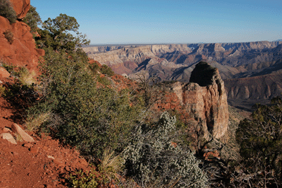
It was 5:25 pm when I topped out on the rim. The hike had taken ten hours from the river and seven from Nankoweap Creek. I was pleased to see some familiar faces at the overlook. Richard Perry, his friend Keith Beaty, and Bob Holland were enjoying dinner when I arrived. Although I know Richard and Bob from their contributions to the "Grand Canyon Hikers" Yahoo discussion group--Bob is the owner--and from their web sites, this was my first time meeting them, in person. It was a real treat to chat with them as I retrieved my supply cache and organized my gear for the hike to the Trail #57 parking area. Darkness would be falling soon so, I didn't have much time to visit. Besides, the wind was picking up tempo which made the exposed overlook quite brisk.
After wishing them well on their hike, I set off down trail on the last leg of my hike. I paused just a few minutes at the place where I had camped on Sunday to say, "Hello," to a group of four backpackers who had preceded me up the Nankoweap trail from the creek. They were spending the night before hiking out and had a roaring fire going in their National Forest spot.
By the time I arrived on Trail #57 in the bed of Saddle Canyon, dusk was thickening and visibility poor. My headlamp was of limited use and I relied on instinct as much as anything to stay on the trail. Finally emerging from the creek bed, the trail began its short but steep ascent along the slope of a hill. My legs and lungs rebelled at the thought of another climb but they had no choice. The long straight section of trail going steadily down from the hilltop to the parking area seemed to go on endlessly. Had I lost the trail? I didn't think so. Had I passed through the trailhead without noticing? Not possible. Eventually, I arrived at the twin signs marking the trailhead. My Isuzu Rodeo was just a short walk away. Once inside, I changed into fresh and clean clothes, and drank a bottle of Gatorade.
A three and one-half hour drive remained but I was already home.
 |
 |
 |